Sections of the South Fork
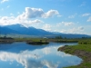
Upper Section
The upper reaches of the river stretch for approximately 18 miles from the Palisades Dam down to the Conant Valley access. The section from the dam through the first nine miles offers a fairly narrow and deep channel, and as the river spreads out below Irwin, a series of islands and side channels and several gravel bars present opportunities that definitely will challenge the skills of the best creel men.
Access to this section off of Highway 26 is available just below the dam, in Irwin at the Sportsmen’s Access and at the Swan Valley Bridge (also known as Spring Creek Bridge). Several boat launches on the Snake River Road side of the river can be reached by driving across the dam at Calamity
Point or by entering Snake River Road on the west side of Swan Valley Bridge.
Wade fishermen easily can access the river just east of the Swan Valley Bridge either on Highway 26 or off of Snake River Road between the bridge and Fall Creek Falls. Winter flow levels (October to March) usually run between 875 to 1150 CFS, and really open up this upper section to waders.
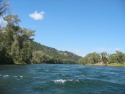
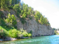
Canyon Section
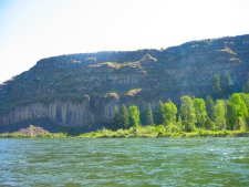
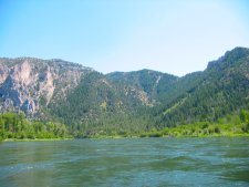
The approximate 24-mile Canyon stretch is the section of the river from the Conant Valley access to the Byington access and presents a contour comprised of volcanic cliffs and a cottonwood forest river bottom which is home for the largest bald eagle winter roost in the Northern Rockies.
 Foot access is more difficult in this section, but it is not uncommon for floaters deep in the canyon to find a few side channels where wade fishing and angling from the bank is possible.
Wading safely and knowing the float area are critical in this section because it is not without swift currents, deep pools, irrigation diversion dams and large eddies.
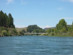
Lower Section
The final some 25 mile section of the South Fork expanse extends from Byington to Menan, and based upon the opinions of the expert guides in the area, is the “most technical section” to float on the river. The runoff debris coupled with stumps and logjams and numerous side channels that vary from year to year severely test the float skills of the best fishermen.
A bonus in this section is the abundance of brown trout in far greater numbers than in the two upper sections. Below Twin Bridges, the spectacular scenery that marks the entire expanse of this quality fishery continues as the river begins to widen as it flows through farmland.
About the Native Yellowstone Cutthroat Trout
Although rainbow trout are native to western North America, they have been widely introduced into many watersheds where they were not historically found. Prior to the 1880’s, Yellowstone cutthroat trout were the only trout in the upper Snake River and Yellowstone River drainage. Although other fish species have been introduced within this range, rainbow trout appear to be especially detrimental to native Yellowstone cutthroat trout populations because they are ecologically similar to cutthroat trout and can form fertile hybrid offspring.
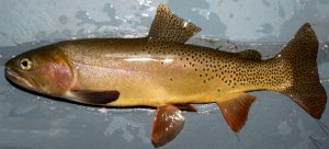
Rainbow trout were regularly stocked into the South Fork of the Snake River until the mid 1980’s when fisheries biologists began to notice growing rainbow trout and hybrid trout populations while pure Yellowstone cutthroat were declining. The Idaho Department of Fish and Game has changed fishing regulations to protect remaining cutthroat trout through a catch-and-release only policy for cutthroat trout and the encouragement to harvest of all rainbow trout and hybrids. The South Fork Snake River represents one of the last large river habitats where native Yellowstone cutthroat trout remain. In addition to the fishing regulations enacted to reduce rainbow trout and hybrid trout, other researchers are working with agencies in charge of controlling dams for irrigation and hydro-power to create more natural flow regimes in the South Fork of the Snake River which may benefit pure Yellowstone cutthroat trout populations.
 483-2150")